Parks, Trails, and Hiking
***Open/Close a selection by clicking on the title.***
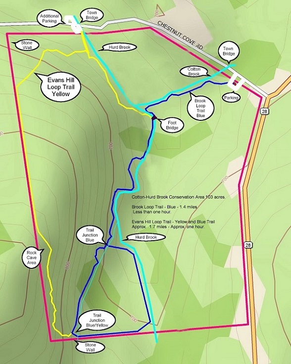
Cotton-Hurd Brook Woodland Preserve
Location
Located on Chestnut Cove Road (Off Route 28N)
Need Directions? Click here -> 
Facts about this Trail
- 103 Acre Parcel Maintained by LRCT
- Well-marked trail system that crosses two streams
- Brook Loop Trail (blazed blue) is 1.4 miles long
- Evans Loop Trail (blazed yellow) is 1.7 miles long
- Approximately a one hour hike
- Rock caves, stone walls, shaded woodlands, brooks
Location
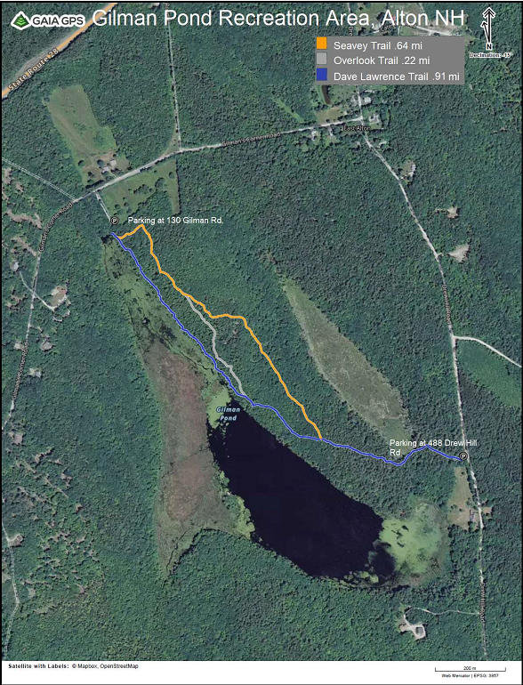
Located on Gilman’s Corner Rd (off Rte 28N) in East Alton
Need Directions? Click here -> 
Facts about this Trail
- Hiking trails and walking paths
- Fishing
- Canoe and kayak access
Location
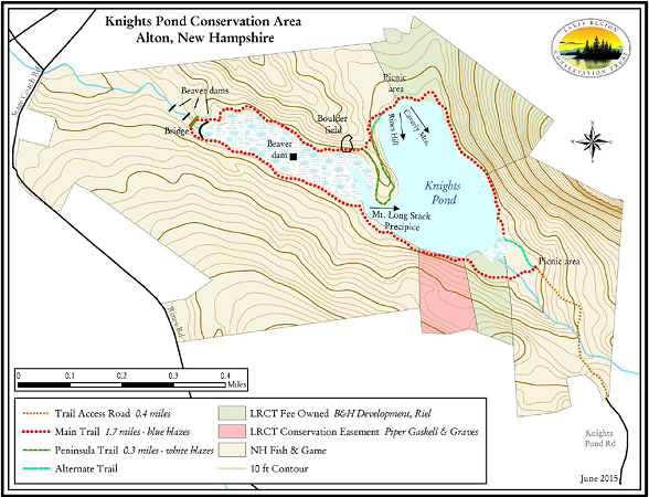
Knights Pond Road is located about 1.1 miles down Rines Road (off of NH Route 28) in East Alton. Follow Knights Pond Road until you see the Sign and Gate.
Need Directions? Click here -> 
Facts about this Trail
- 37 acre body of water (knights pond), 307 acres of surrounding conserved land
- Conserved lands were donated and purchased by LRCT and acquired by the State of New Hampshire in both 1989 and 1990
- Designated parking area, Picnic Areas, Beaver Dams, Boulders, Bridge
- .04 mile hike from parking area to southeastern shore of knights pond
- A 1.7 mile long trail (blazed blue) circles the pond
- At the northwestern shore of the pond, there is a 0.3 alternate route (blazed white) through boulders and tall pines
- The entire hike starting from the parking lot and around the pond and back is 2.8 miles in length
Source of Information: Lakes Region Conservation Trust
Location
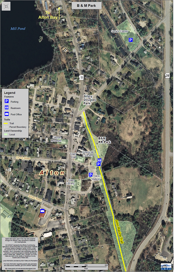
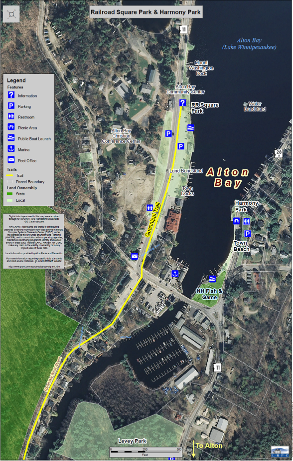
Located at 13 Depot Street. Behind the Town Hall and to the left of the Alton Police Station.
Need Directions? Click here -> 
Facts about this Park
- Toddler Playground
- Wetlands Boardwalk
- Horseshoe Pit
- Bocce Court
- Linked Walking Trail (John Racine Trail)
- Picnic Area with Benches
- Historic Train Buildings and Caboose
Location
Adjacent to the Alton Town Beach on East Side Drive (Route 28A).
Need Directions? Click here -> 
Facts about this Park
- Dedicated to the Norwich, CT chapter of the Society for the Preservation and Encouragement of Barbershop Quartet Singing in America
- Covered Picnic Table Area and Benches
- Fishing
- View of Alton Bay and Water Bandstand
- Close to Town Beach
Location
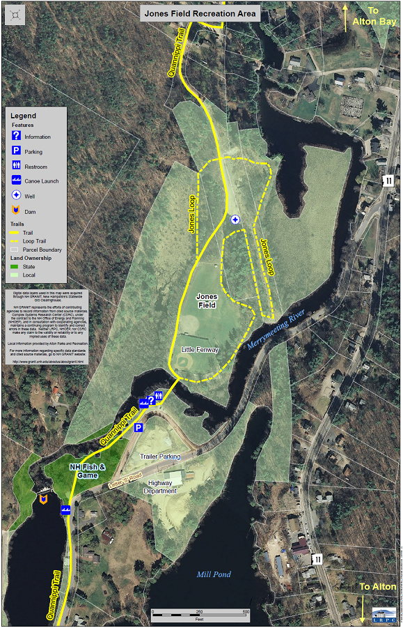
Parking for Jones Field is located on Jones Field Road, which is a dirt road directly connected to Letter S Road by the Highway Department.
Need Directions? Click here -> 
Facts about this Park
- Home of "Little Fenway"
- Baseball and Softball Fields
- Playgrounds, Swings
- Picnic Area with Tables
- Fishing
- Canoe and Kayak Launch on Merrymeeting River
Location
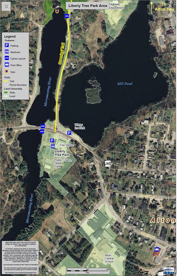
Located at 65 & 67 Frank C Gilman Highway (Rte 140, behind the Central Fire Station). There is a well marked area for Visitor Parking at the Fire Department.
Need Directions? Click here -> 
Facts about this Park
- Tennis Courts with Pickleball Court Lines
- Basketball Courts
- Sand Volleyball Court
- Skate Park
- Slide and Swings
- Picnic Areas and Benches
- Seasonal Drinking Water
- Canoe and Kayak Launch on Merrymeeting River
Location
Located adjacent to the Alton Bay Community Center on NH Route 11.
Need Directions? Click here -> 
Facts about this Park
- View of Alton Bay
- Swim Dock
- Seasonal Lifeguard
- Picnic Tables and Benches
- Seasonal Drinking Fountain
- Boat Launch Ramp
- Boat Docks

Location
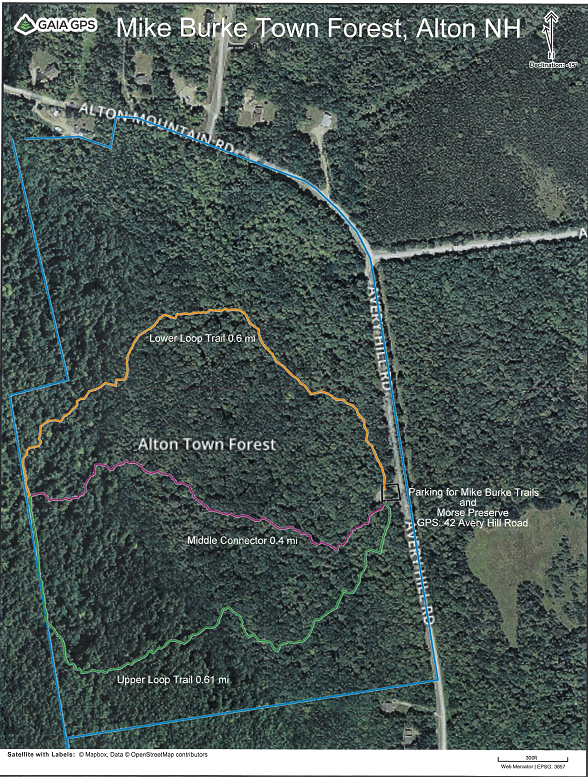
Located on Avery Hill Rd at Alton Mtn Rd
Need Directions? Click here -> 
Facts about this Trail
- One mile loop trail in the Town forest
- Hiking, snowshoeing, wildlife
Please Note: This page is currently under construction. Check back later for additions and more information.
